withlacoochee river-south (lacoochee boat launch to bird creek boat ramp), FL Overall FKP Details


Withlacoochee River—South Overall Fastest Known Paddle: 2D, 7H, 1M
(this is also the 1st solo female male FKP)
Emily Broderson, age 47, of Maple Grove, Minnesota, USA.
March 19-21, 2025
98.6 miles
Supported (note: this was considered supported because their were friends at the cabin Emily stayed at the 2nd night of the trip)
Start: Lacoochee Boat Launch, Dade City, FL. 8:49am EST, March 19th.
Finish: Bird Creek Boat Ramp, Yankeetown, FL. 3:50pm EST, March 21st.
Support Crew: none
Boat: Savage River Blackwater C1 Canoe
Maps: Florida Dept. of Environmental Protection maps.
Trip Report from Emily Broderson:
I have been paddling the stretch of the Withlachoochee river several miles upstream and downstream of the confluence with the Rainbow River consistently every March for many years now as part of an unofficial marathon canoe racing training camp. Occasionally we've driven to Silver Lake as well and gone up and downstream from there. I was always curious what the river was like in other sections and as it nears the ocean. This year I decided to find out what those blue lines on the map actually looked like. Undertaking to establish a Fastest Known Paddle time gives an "officialness" to what could also be called, "Going on an adventure."
I wasn't really sure where I should start the journey. I decided to do some scouting - which could also be called "going on a road trip adventure in central Florida." The Withlacoochee River starts somewhere in the Green Swamp. I looked at where the blue line on Google Maps ended and followed it down to the first road crossing. I drove there only to find out that it was a private road with a locked gate. Same for the second road crossing. The first public road crossing was Highway 471, There is not an official public boat access there but you could put a canoe in. I went there and took a look and just about 50 meters downstream there were some downed trees completely blocking the river. I was quite worried about deadfalls and having to spend a lot of time and effort getting around/under/over/through obstacles. Looking at the satellite images on Google maps, I also noticed that there were certain sections of the river where there was no indication that there was a river there, just undifferentiated trees. If a tree falls down in those sections it's going to block the river. The State of Florida designates certain paddling trails and publishes maps. My thought was that if the state publishes the route as a waterway they probably make some effort to clear it enough for paddling so I decided to start where the Water Trail starts, at a public boat launch just east of the town of Lacoochee.
My friend and fellow Minnesota Canoe Association board member, Anne Manns, offered to drive me to the put-in. For this trip I had decided on two pre-planned overnight stopping points. The first was the Trails End RV park about 36 miles downriver of where I put in. I wasn't quite sure what sort of time I would make, particularly if I got slowed down by having to get through downed trees but I figured if I started around 9am I would hopefully arrive by sunset. It turned out that whoever's job it is to make sure the river was passable did their job! There were numerous downed trees and debris but at every one of them there was just enough room for a canoe to get through. Some were a little bit tricky to navigate but there was not much current so you could easily just back paddle to get out of a situation. It was clear that the water had been much higher than it currently was. I saw a chair in a tree about 10 feet above my head and there was a fair amount of debris on the banks and in the vegetation on shore. This upper section of river was fairly narrow, generally had defined channel banks with a few sandstone outcroppings visible. Occasionally there were rocks, easily avoidable. The scenery was beautiful Florida with lots of birds and many turtles. I did not see any alligators the first day but I did hear some splashes as I came around corners. I passed by a man who was fishing from his dock up above the river and he asked me if I had room in my canoe for two pieces of garbage on the far bank that had been an eyesore for him since the hurricane passed through last fall. I happily obliged and added a small plastic garbage can and an outdoor furniture pillow to the bow space in my canoe.
As I neared Silver Lake I realized that the water levels were significantly higher than I'd seen them before in March. I crossed the lake and stopped briefly to put the trash can and pillow in a garbage receptacle. I saw my friends' cars from the canoeing camp parked there and knew that they had gone downstream for their paddle and looked forward to running into them. And, after a while, I did. It was fun to see familiar faces and I gave a small hatchet/saw back to Gary Aprea who had loaned it to me in case I needed to cut through vegetation on the upper portion of the river. I figured I wouldn't need it any longer.
I got to the RV park around 6:30pm with plenty of daylight but I was tired and ready to stop. When I made the reservation I told them I would be arriving by canoe and they gave me a spot right by the river. A couple of campers had been alerted that I was arriving and stopped by to say, "Hi". They were curious about my trip and it was fun to talk with them.
On the second day I didn't start right at sunrise because I needed to charge my phone more and I thought I could pretty easily make it to my next overnight stop - the Rainbow Rivers cabins about 38 miles downstream, where I had been staying, before sunset. Everything was going well until I took a bad cut. Coming into Princess Lake the river divides in two to enter the lake. The Florida Designated Trails map indicates to take the right channel but Google maps shows that the left channel cuts off a significant distance and the left channel is even labeled as "Withlacoochee River". There was clearly more water going to the right but I decided to take the cut to the left. I got into it and pretty quickly it was just dollar weeds so I was plowing through them slowly and with a lot of effort. It was a challenge to figure out where the river even went. Then I was not in dollar weeds anymore but in full-blown cypress knee swamp. I had to stand up in my boat to get perspective on the best route through. It was definitely a three dimensional brain challenge! I was doing fine and telling myself that I was making progress even though it was slow and I had enough food and water and everything was okay until...I was about to grab a branch to pull myself forward and realized it was poison oak! Yuck!! That was when the swamp started to feel sinister. At one point I realized that a path forward was actually looking clearer to the left than the route shown on Google so I cut that way and ended up in a different bay than I had intended. But I was okay and my boat was okay and I had survived the swamp cut! My guess is that I lost about an hour taking that cut.
The rest of the day was fairly windy. Wind from all directions as the river turned. The previous day I had not used my rudder at all but on the second day it was very helpful to keep me from getting blown around too much or having to spend a very long time paddling on one side. And even though I had camping gear I was still a fairly light boat and got pushed straight laterally sometimes. Oh, well. #lightboatproblems. I saw some fishing boats and there were a few airboats. You can hear them coming! It looked like they were all chartered tours and the operators appeared to be looking out for small craft, giving me a wide berth. Above the 44 Bridge there was a small dam with a pop-over portage. The airboats popped over too on a special ramp. I happened to see two of them go over and the passengers looked like they enjoyed the experience.
As I was coming in toward the Rainbow Rivers cabins I started seeing familiar landmarks. It was amazing to me how things looked different when I was in canoe tripping mode vs. canoe race training mode. I was noticing all kinds of details that I had never seen before because my field of vision was wider than, "Where are the waves? What are the boats around me doing and how do I set up for the next turn?" I was getting kind of tired and dawdling, even having a text message conversation with my friend Maria. As I got closer though I decided to have one final granola bar and make a good push into the cabins. Turned out that my friends had been watching my tracker and were planning to meet me when I arrived. When they got to the dock I was just getting out of my boat. It was still daylight but dusk came soon. That night I stayed in my "home away from home" cabin, ate a good hot dinner and took a shower.
The final day felt like a day-trip as I ditched the camping gear and only brought a small backpack with food and water. I was on the water at first light and made good time downstream though the cuts that I was familiar with. Just as I got to Lake Rouseau the wind picked up from the north as the forecast had predicted. I chose a route that hugged the protected north shore of the lake. There are numerous routes one could take across the lake. One is to stay inside a marked shipping channel which keeps you out of the stumps but at the current water level and with my boat draft there were no issues with stumps. There were a few I could see that were easily avoidable. It was a Friday and quite windy so there weren't many motor boats out.
As I was paddling along I heard a funny noise and then realized that my rudder system had broken. The crimp which keeps the pedal wires tight came loose on the right. This didn't surprise me because the crimp on the left had already come loose on the boat's third outing and Ryan Stepka had helped me fix it. I ended up fixing it by tying the wire through one of the holes on the foot brace. Amazingly, that worked! I was very happy. The only downside was that I had to keep the seat in the far back position the whole time but I just put my water bottles in the bow when I wanted to be more level. If I hadn't been able to fix the rudder I think I would have been able to finish but it would have been very challenging, particularly in some of the cross-wind crossing sections. I surfed downwind for a bit into the small bay near the dam. I still need to work on my downwind surfing skills in a canoe...
I was glad I had scouted the portages so I knew where to go. The wind was pushing on my boat but I was able to handle it. It is so fun to have a light boat for portaging. I walked right into the river and plopped the boat down off my shoulders. No problem!
The section below the dam (with no water coming out from it) was pretty but felt like paddling in a ditch. The banks were high. The water was sucky - meaning the boat's wave was pushing back against the boat and slowing it down. There were some fishermen trying to catch catfish and just as they admitted they hadn't gotten a bite a big catfish jumped out of the water right in front of me. I got to the canal and found the map pin I had dropped marking the best take-out spot for the next portage. It was a tough though: riprap rocks with green slime on them. I managed to carefully get my boat out and up onto the bank. This portage was fairly protected from the wind and went smoothly after the take-out. Again, I was really glad I had scouted it and knew where I was going.
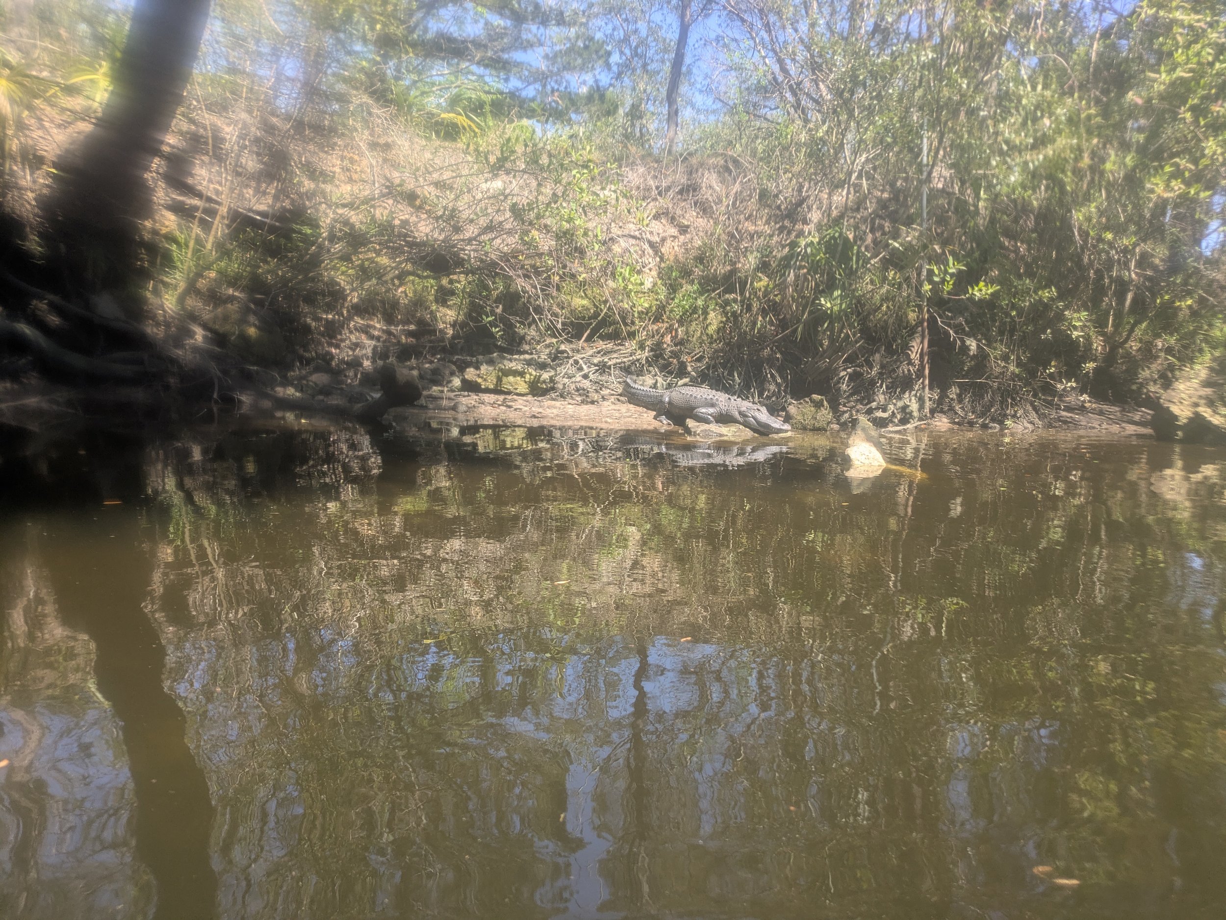
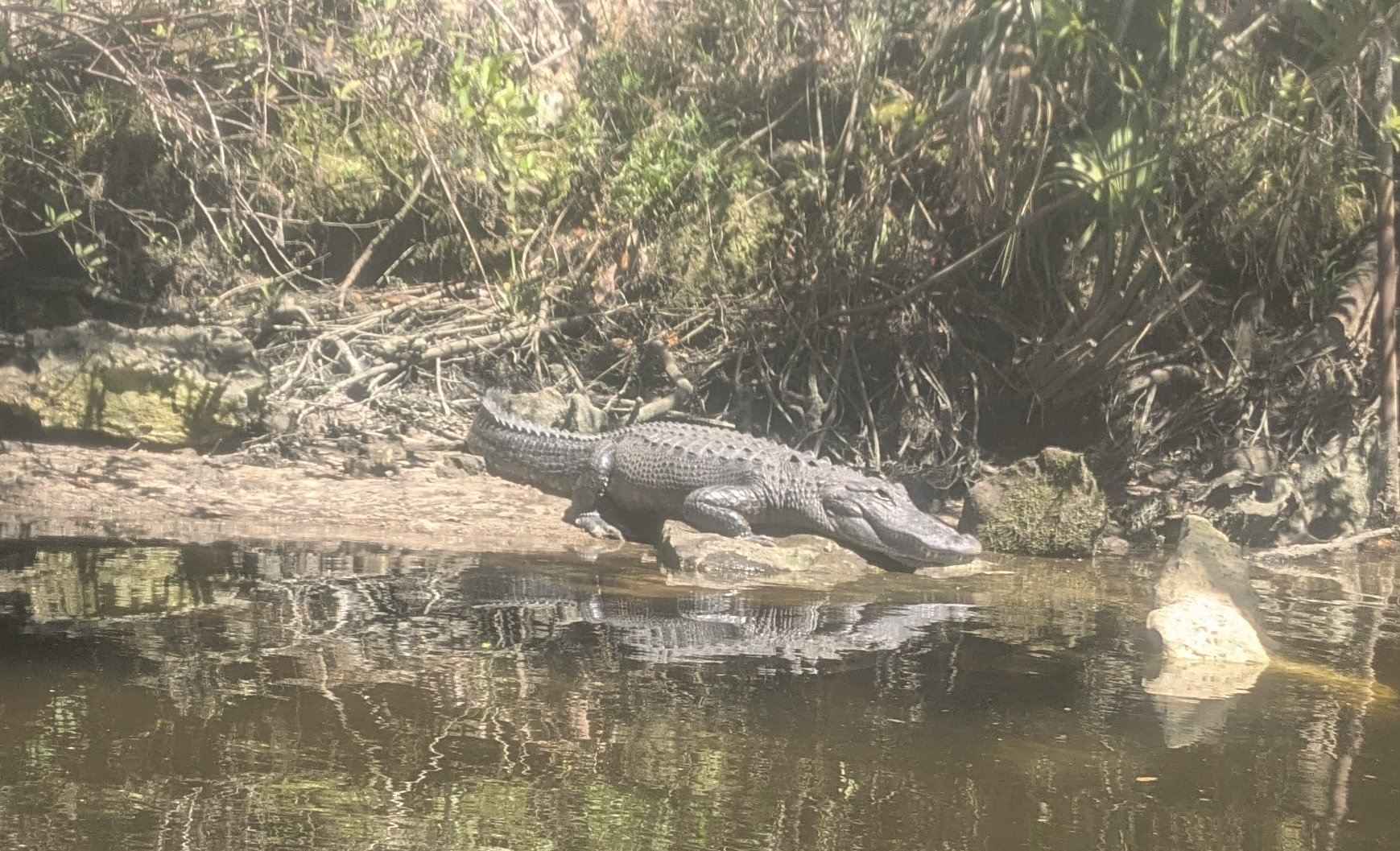
Next stretch in the spillway-fed river was mostly in a well defined, deep channel with houses along both sides. Things started feeling "oceany" when I saw ocean-going ships moored on docks. A surprising number of the ships were swamped, partially swamped or in extreme dis-repair. I was moving well and making faster time than I expected. I was also realizing that I mis-gauged the distance. I thought it would be about 30 miles for the day but my GPS only showed 25 miles in the end. Thankfully Anne was flexible and the pick up spot was only a half hour from our cabins. I saw a manatee in the dark water and I was surprised. I hadn't been in "looking for manatees" mode. The dam keeps them from upper sections of the river. Several alligators were sunning themselves on this stretch of river and I saw two raccoons in broad daylight. After Yankeetown things flattened out and there was a fairly stiff on-shore breeze. I was once again thankful my rudder was working. I went into "horse smells the barn" mode and Anne, who was at the boat launch waiting, didn't even see me come in. It was pretty fun to paddle my little canoe in the ocean waves, if only briefly.