loop around mobile bay (l.a.m.b), AL FKP Details

Loop Around Mobile Bay (L.A.M.B.), Alabama Overall Fastest Known Paddle: 1D 7H 50M
Ryan Gilikin of Bay Minette, Alabama, age 46
April 12th-13th, 2025
Distance: 100 miles
GPS tracker used: Garmin Oregon 700
Supported
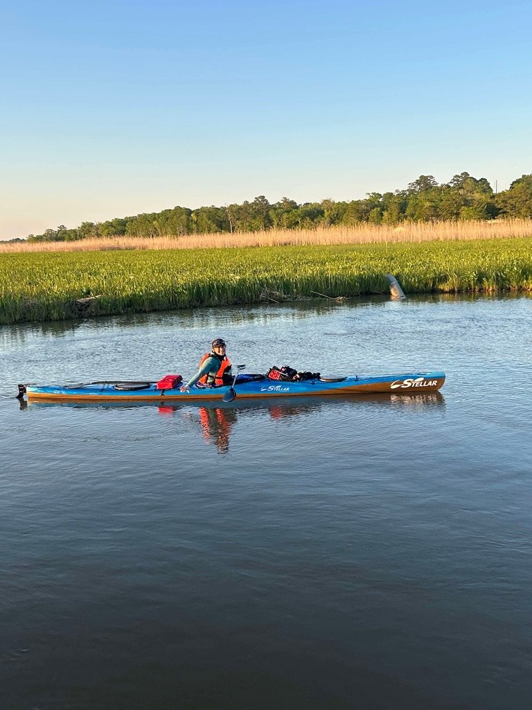
Boat used: Stellar S18r
Start: Hooked Up By The Bay Boat Ramp, Spanish Fort, Alabama, 11am on April 12th.
Finish: Same place. Ryan finished at 6:50pm on April 13th.
Notes from FKP founder Scott Miller: Ryan is the first to set an FKP on a loop route. Ryan’s came up with the innovative idea that you have to travel at least a set amount of distance on a loop route (in this case, 100 miles). The idea is this will help keep people as close to shore as possible (for safety) and create a standard that people can use to try and set time records. You have to do a complete loop; if someone goes over 100 miles that’s OK you just can’t go under 100 miles. Ryan set her GPS device so she could see how far she’d gone and how far she had to go, so she can slightly modify her route as needed to make sure she gets over 100 miles, which she did!
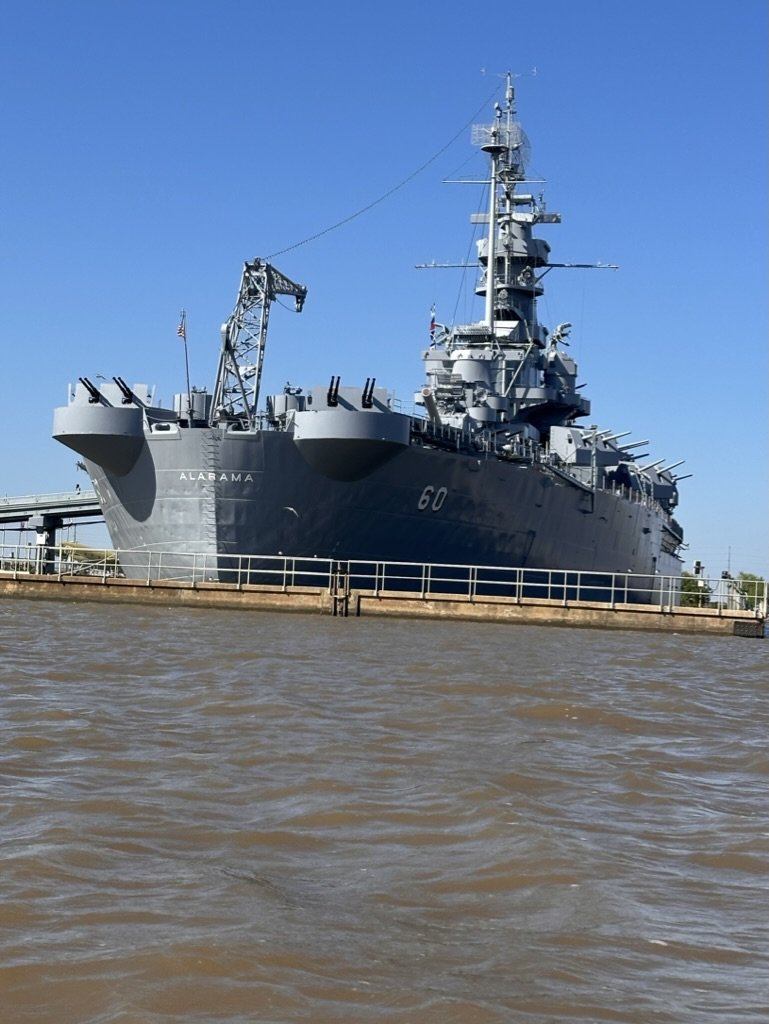
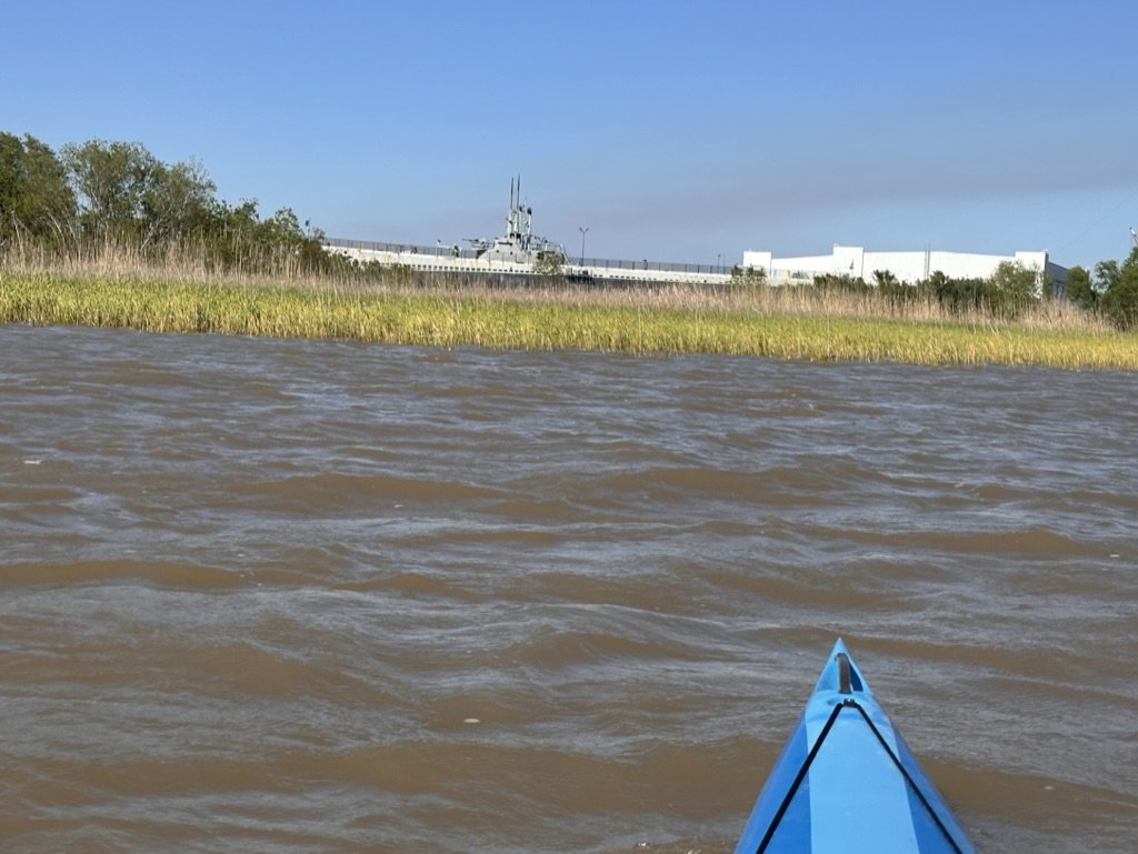
Route notes from Route Creator Ryan Gilikin: L.A.M.B. stands for Loop Around Mobile Bay. The original L.A.M.B. ride was a Loop Around Mobile Bay that the local bicycle clubs did. It was a 100 mile bike ride that circled the bay and the used the Dauphine Island ferry to close the loop at the bottom. I (Ryan Gillikan) have long desired to create a L.A.M.B. paddle, a 100 mile circumnavigation of Mobile Bay. My goals in creating the route were to get as close to 100 miles as possible, avoid mud flats and shallows so that the route can be done without getting out of the boat and to create a true circumnavigation that starts and stops at the same place. This route encompasses several different environments from brackish marsh at the mouth of the bay, open water bay paddling and sandy beaches as the bay empties into the gulf. Notable features include the Dog River and Dauphine Island bridges and the route goes right past the USS Alabama. At the top of the route you have to stay in the channel to avoid the shallows and mud flats of the delta. Part of this involves paddling under the I10 interstate. I plan to start at Hooked up By the Bay boat ramp but someone repeating the route could start at a number of boat ramps around the bay. It could be done clockwise or counterclockwise. I would say that to repeat the challenge it would need to be a total of at least 100 miles. Part of the challenge of navigating is to try to get as close to 100 miles as possible so you complete the challenge without doing extra miles.
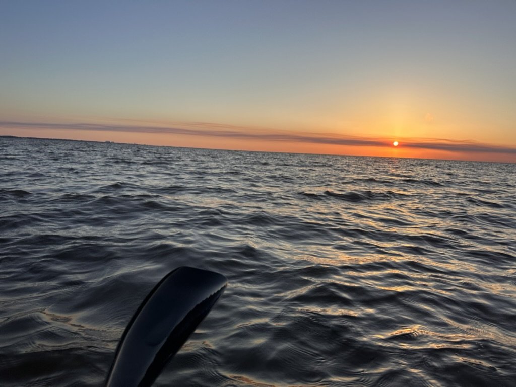
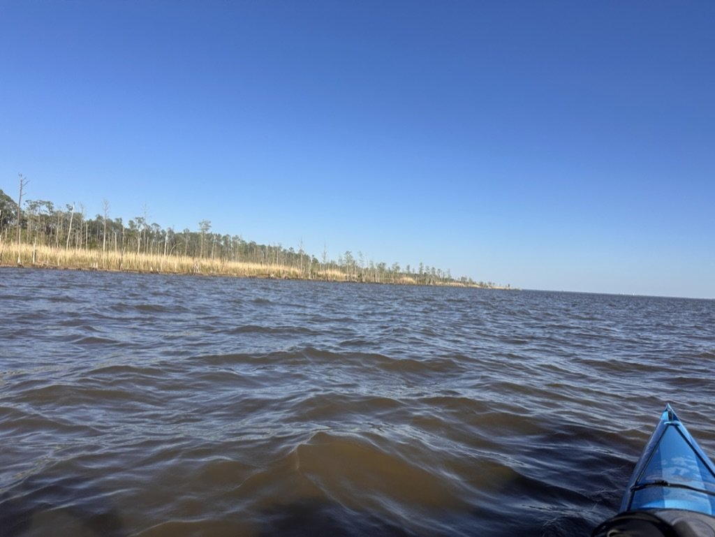
Trip Report from Ryan: I launched from Hooked UP By the Bay boat ramp in the north east corner of Mobile Bay at 11am. I launched at high tide to get some assist heading out of the delta. Waters were high from a recent rain so I had a little current to get started. My GPS is a garmin Oregon 700. I had 2 running at all times and a third one in my dry back for back up. I started my tracker at the Cochran Bridge 50 yards south of the boat ramp to create a start and finish line. I completed the route clockwise. I started out heading south on the eastern shore of the bay. There is a channel called Turtle Ditch that you have to follow for the first couple miles to avoid the mud flats. as soon as I was able I moved over and started hugging the shore. I stopped to resupply at about 25 miles at the mouth of Week's Bay. My mother, Randi Evans, provided ground support throughout the trip. After a quick stop I was back on the water. Winds were 5-10 out of the NW providing additional assist. This part of the bay is actually Bon Secour Bay but it contiguous with Mobile Bay and thus including in the circumnavigation. After about 12 miles I stopped at Bay Breeze RV park for pizza and hot chocolate. I was now headed west following the Fort Morgan Peninsula. I reached the half way poont of 50 miles in 13.5 hours and was making good time. This is also the finish line for the Alabama 650 race and the end of the Fort Morgan Peninsula. Up to this point I had had great conditions and calm seas. Next up was a 3.5 mile crossing to get to the Tip of Dauphine Island. All of the waters of the bay have to exit through this narrow channel and I was no longer protected from the wind and waves of the Gulf. I picked my way carefully across while also watching for any boats in the shipping lanes. Once I made it across, at about 2am, I was approached by a coast guard vessel but after checking me out they moved on. I next had to follow the Dauphine Island Bridge 2.5 miles to get up to the mainland and meet my crew again. There were not a lot of options here so we ended up landing on a small piece of beach just north of the bridge. I was still very weak after eating from exerting myself in rough conditions and not eating enough. I was not ready for a surf launch and more rough weather so I rested for 90 minutes and was back on the water at dawn. It took me 3 tries to get the surf launch so I was starting the day wet but it soon warmed up and conditions had improved so I had a nice 20 mile paddle to lunch at The River Shack under the Dog River Bridge and even saw some dolphins. Fortified with burgers and fries I felt strong and just had 20 miles left to paddle. As I approached the north west corner of the bay conditions quickly deteriorated. THe tide and currents tath had helped me on the fist couple miles of my trip were now pushing me out and the north wind was opposing the current kicking up large waves. I struggled to make any headway and missed a mile of my route because it was too difficult so stay on my line and barge traffic kept me out of the mouth of the Mobile River. I was able to make up the distance by hugging the corner at Battleship Park which took me right by the USS Alabama, a submarine and various artillery pieces on display. I entered the delta agin by crossing under the I-10 bridge. I now had to make my was back east to close the loop but the delta is very shallow and I had to follow channels and create a route that would get me across. I paddled under I-10 and then followed the causeway east. There was a large Island that I had to go around to get back to my starting point. I then had to paddle upstream for 2.5 miles on the Apalachee River to the top of the island then turn back down stream 2.5 miles to the finish. When I made that last turn I cut it sharper then my route did so I was now 0.1 miles short of where I needed to be to reach 100 miles at the finish. I was able to move over to my left and come down a small bayou then cut over through a slough to get back to the main river before passing under the bridge and closing the loop with 100.05 miles showing on my GPS.