Colorado River (source to CO/UT state line)—Overall fKP Details


Colorado River(Source to CO State Line) Overall Fastest Known Paddle: 2D 19H, 54M
(this is also the 1st place Tandem Male FKP)
Ryan Ognibene, age 32, Boulder, CO & Julian Tonsmeire, age 44, Golden, CO
June 11-14, 2020
308 miles
Unsupported
This is the overall FKP as well as the fastest tandem male FKP
Start: LaPoudre Pass, Headwaters of the Colorado River. 4:20pm, June 11th
Finish: Westwater Boat Launch, Utah 10:54am, June 14th
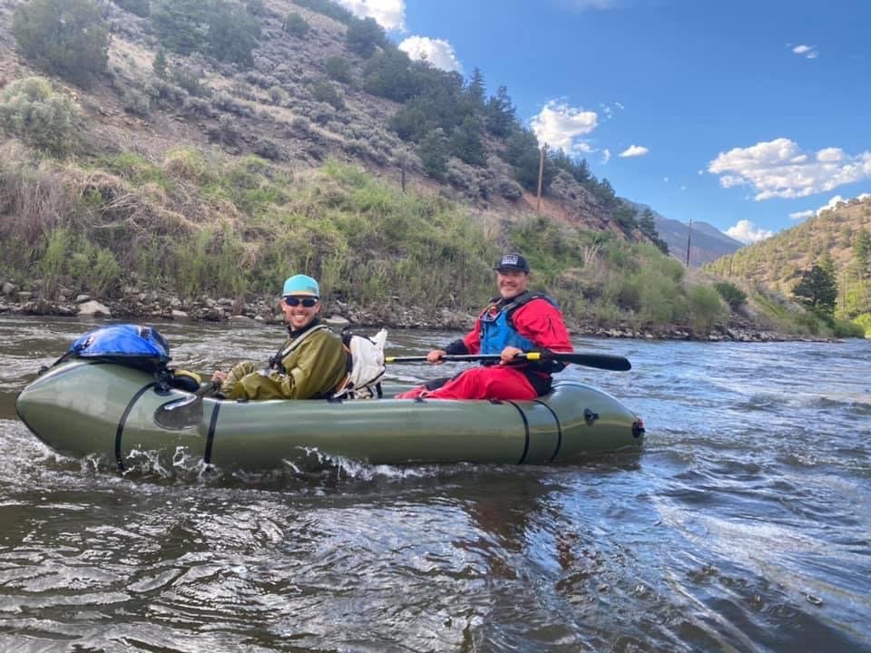
Boat: Alpacka Forager Packraft
Full Trip Report from Ryan Ognibene
This 308-mile endurance journey followed the Colorado River from its source at La Poudre Pass (10,145 ft) to the Colorado-Utah state line (4,025 ft). The route traversed high alpine terrain, dam-controlled reservoirs, deep canyons, and remote desert landscapes, requiring a mix of hiking, paddling, and portaging.
The paddlers adhered to strict unsupported expedition rules, carrying their gear from start to finish and staying as close to the river as safely possible. Numerous rapids, portages, and private property restrictions added complexity, making this a true test of endurance and navigation.
Memorable Moments & Reflections:-"ALL OF IT!" – When an Uber driver in Fruita asked which section of the Colorado we rafted, Ryan replied without hesitation: “ALL OF IT.”
-Witnessing the stunning transition from alpine meadows to desert canyons.
-The realization of how dammed and diverted the Colorado River is—despite this, wildlife thrives.
-5 years of dreaming, 3 years of planning, and one unforgettable adventure.-Start Elevation: 10,145 ft (La Poudre Pass, CO)
-End Elevation: 4,025 ft (Westwater, UT)Special Rules:
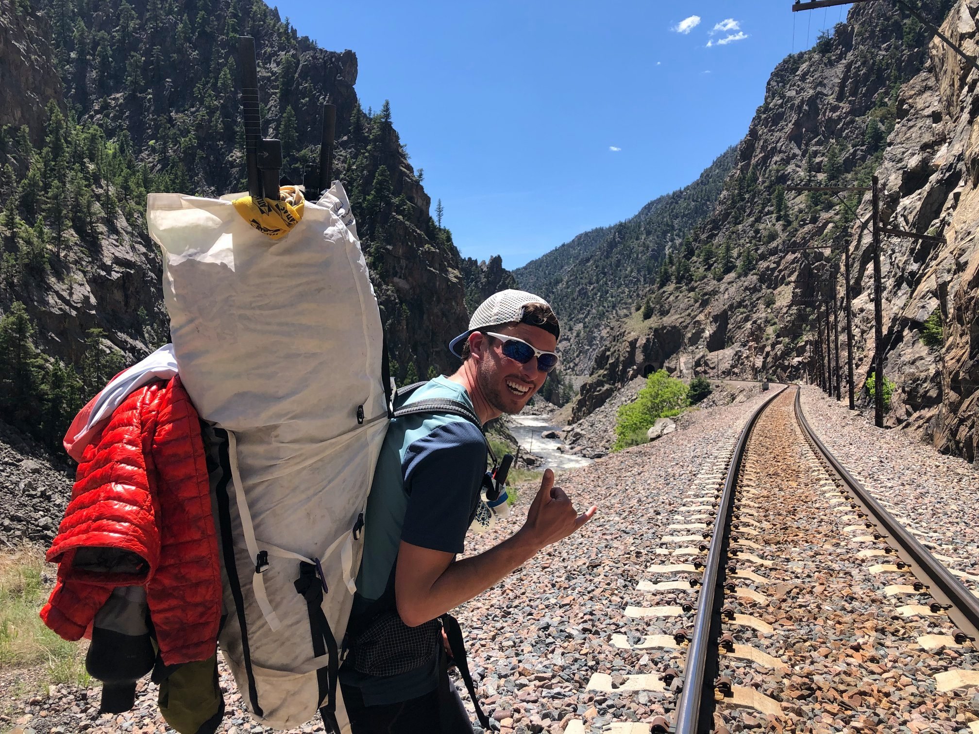
Must stay as close to the river as safely possible.Unsupported: All gear and the boat had to be carried from start to finish.
Portaging allowed for rapids, private land, and night travel.
Route Breakdown:
Section 1: RMNP Portage (La Poudre Pass to Shadow Mountain Reservoir)
Terrain:
-High-altitude alpine trek along the infant Colorado River.
Highlights:
-Start at La Poudre Pass (Continental Divide).
-Encountered elk, moose, and beavers along the way.
Challenges:
-Hiking with gear in rugged terrain.Section 2: Shadow Mountain & Grand Lake Paddle
Terrain:
-Flatwater paddling across Shadow Mountain Reservoir and Lake Granby.
Highlights:
-Beautiful alpine lakes with cold, clear water.
Challenges:
-Cold conditions.
-Strong winds could be a factor.Section 3: Portage to Windy Gap Reservoir (9-mile road walk)
Terrain:
-Road hike due to private land restrictions.
Challenges:
-No legal access to paddle sections between Granby Dam and Windy Gap Reservoir.Section 4: Windy Gap to Gore Canyon
Terrain:
-Flatwater paddling resumes with some mild current.
Highlights:
-Entering Byers Canyon and Hot Sulfur Springs.
Challenges:
-Portaging small rapids and dams.Section 5: Portage of Gore Canyon (5.5 miles)
Terrain:
-Extreme whitewater in Gore Canyon (Class V+).
Challenges:
-Dangerous rapids required a full portage on rugged terrain.Section 6: Upper Colorado Paddle (Pump House to Glenwood Canyon)
Terrain:
-Continuous flowing river with moderate rapids.
Highlights:
-Classic Upper Colorado section with deep canyons, stunning geology, and wildlife.
-Radium Hot Springs, State Bridge, and Glenwood Canyon.
Challenges:
-Multiple Class III+ rapids requiring careful navigation.Section 7: Glenwood Canyon to DeBeque Canyon
Terrain:
-Wide, meandering river with occasional rapids.
Highlights:
-Glenwood Springs Whitewater Park (portaged).
-Scenic DeBeque Canyon.
Challenges:
-Portaging multiple dams.Section 8: Ruby-Horsethief Canyon to Utah
Terrain:
-Final stretch into desert canyon country.
Highlights:
-Towering red rock cliffs.
-Bald eagles and river otters along the banks.Final Push:
-Long paddle through Ruby/Horsethief Canyon into Westwater, Utah.Logistics & Considerations
Water Supply:
-The Colorado River was the primary source, but some sections had high silt content. Filtering was necessary.
Weather & Wind:
-Conditions varied from cold alpine air at the start to hot desert temperatures near Utah.
-Wind was a factor, particularly on open lake sections.
Permits:
-No permit required for the full route.
-However, land access restrictions necessitated several long portages.
Shuttle & Extraction:
-The trip ended at Westwater, Utah, where a pre-arranged shuttle was needed for pickup.